SH1 Dunedin
State Highway SH1 • Otago, New Zealand


Interested in this camera?
You can save it to your favorites and visit it whenever you want in the KiwiCamsNZ app.
About SH1 Dunedin Live Feed
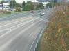
North along SH1 Andersons Bay Rd
Active NZTA Alerts Near This Camera
Bridge Repairs — SH 1 Green Island, Burnside Overbridge
Due to bridge repairs, the Burnside Overbridge will be closed in both directions with lane closures in place on SH1 from Monday 9th November to Friday 13th November and Monday 23rd November to Thursday 26th November between 9pm and 5am. Take extra care and plan your journey accordingly.
Road & Driving Conditions Guide: SH1 Dunedin
This roadside webcam at SH1 Dunedin on State Highway SH1 helps commuters, freight drivers, and holiday travellers verify live lane flow, surface moisture, fog, and roadwork queues in Otago before entering the corridor.
Because static GPS traffic lines do not always show heavy rain spray, surface flooding, or contraflow cones, checking two or three consecutive cameras along SH1 gives a reliable real-time picture of actual driving conditions.
Frequently Asked Questions about SH1 Dunedin
How often is the SH1 Dunedin traffic camera updated?
Images from SH1 Dunedin are refreshed every 60 to 120 seconds directly from the Waka Kotahi NZ Transport Agency highway monitoring network.
Where is SH1 Dunedin located on the highway network?
This live camera is positioned along State Highway SH1 in the Otago region at GPS coordinates -45.8880, 170.5000.
How can I check if the road at SH1 Dunedin is open or affected by weather?
KiwiCamsNZ displays the live visual feed alongside real-time weather metrics (temperature, wind gusts) and official NZTA hazard notifications within a 15km radius.


About the Author
Víctor Alonso
IT Engineer · Full-Stack Developer · Spain
Computer Engineer specialising in high-performance web platforms and SEO infrastructure. Creator of KiwiCamsNZ, the NZ traffic camera aggregator, and several digital products across Europe and New Zealand.
Journey Safety
Always verify multiple cameras along your planned route. Visual data provides context that GPS maps might miss.
View All NZ Alerts