🏔️ Alpine Weather & Winter Road Conditions

New Zealand Mountain Passes

Live alpine webcams, summit elevation, snow chain requirements, and real-time road conditions for NZ's highest alpine crossings.

1,121m Highest (Crown Range)
9 Alpine Passes
24/7 Visual Webcams
🏔️

NZ Alpine Passes Interactive Map

Click any mountain pass to view summit altitude and nearby live CCTV cameras

North & South Island Crossings
SH1 ⛰️ 1,074 meters North Island
⚠️ Chains / Caution

Desert Road

Waiouru to Rangipo (Waikato / Manawatu)

☁️ -2.3°C (Feels -8.2°C)
Overcast
💨 Wind: 23.7 km/h (Gusts 50 km/h)
🧊 Sub-Zero Summit

The highest point on State Highway 1. Highly prone to severe snowstorms, black ice, and blizzard closures between June and October.
🚧
Other: Due to test pit works, there will be Stop/Go traffic management in place on Monday 17th August between 7am and 7pm. Plan your journey accordingly and expect up to 10 minute delays.
Est. Resolution: Until further notice
🌧️
Snow: Following a prior closure, State Highway 1 has reopened between Rangipo and Waiouru. Road users are advised to take extra care along this route as winter driving conditions remain.
Est. Resolution: Until further notice
🚧
Services: Due to utility works, there is stop/go traffic management with a 30km/h temporary speed restriction in place. Stop on request and drive with caution.
Est. Resolution: Until further notice
SH73 ⛰️ 920 meters South Island
⚠️ Chains / Caution

Arthur's Pass

Springfield to Kumara Junction (Canterbury / West Coast)

☀️ 2.6°C (Feels -1.3°C)
Clear Sky
💨 Wind: 5.5 km/h

The primary alpine highway traversing the Southern Alps between Christchurch and the West Coast. Subject to heavy winter snowfall and avalanche risks.


🌧️
Snow and Ice: The road is now clear.
Est. Resolution: Until further notice
⚠️
Other: Due to vegetation clearing work, there will be Stop/Go traffic management with a 30km/h speed restriction in place from Tuesday 18th August until Sunday 23rd August between 6am and 6pm. Take extra care.
Est. Resolution: 23/08/2026 18:00
⚠️
Maintenance: Due to drainage works, there will be Stop/Go traffic management with a 30km/h speed restriction in place from Monday 10th August to Friday 21st August between 8:30am to 5pm. Take extra care.
Est. Resolution: 21/08/2026 17:00
SH7 ⛰️ 907 meters South Island
🟡 Caution

Lewis Pass

Culverden to Springs Junction (Canterbury / West Coast)

☀️ 3.4°C (Feels -0.6°C)
Clear Sky
💨 Wind: 6.1 km/h

The northernmost paved alpine pass across the Southern Alps. Essential alternative route during Arthur's Pass winter closures.


⚠️
Other: Due to water cutting work, there will be Stop/Go traffic management with a 30km/h speed restriction in place from Monday 17th August until Friday 21st August between 7am and 5pm. Take extra care.
Est. Resolution: 21/08/2026 17:00
⚠️
Other: Due to vegetation clearing work, there will be Stop/Go traffic management with a 30km/h speed restriction in place from Tuesday 18th August until Sunday 23rd August between 6am and 6pm. Take extra care.
Est. Resolution: Until further notice
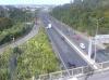
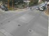
Crown Range Rd ⛰️ 1,121 meters South Island
🟢 Open

Crown Range Road

Queenstown to Wanaka (Otago)

🌤️ -2.3°C (Feels -6.4°C)
Mainly Clear
💨 Wind: 6.5 km/h
🧊 Sub-Zero Summit

The highest paved public road in New Zealand. Spectacular mountain drive with tight hairpin switchbacks. Snow chains are legally mandatory in winter.
SH8 ⛰️ 971 meters South Island
🟡 Caution

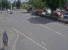
Lindis Pass

Omarama to Tarras (Canterbury / Otago)

☀️ 0.5°C (Feels -3.2°C)
Clear Sky
💨 Wind: 4 km/h

Links the Mackenzie Basin with Central Otago. Dramatic tussock grassland terrain with frequent winter snow accumulation and icy summit conditions.

⚠️
Maintenance: Due to maintenance works, there will be Stop/Go traffic management in place from Monday 17th August to Friday 21st August between 7am and 5pm. Plan your journey accordingly and expect up to 5 minute delays.
Est. Resolution: 21/08/2026 17:00
SH94 ⛰️ 945 meters South Island
🟢 Open

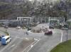
Milford Road

Te Anau to Milford Sound (Homer Tunnel) (Southland)

☀️ 2.4°C (Feels -1.7°C)
Clear Sky
💨 Wind: 7.3 km/h

Scenic alpine corridor to Fiordland. Features the historic Homer Tunnel and active avalanche hazard monitoring during winter and spring.
SH2 ⛰️ 555 meters North Island
🟡 Caution

Remutaka Hill Road

Upper Hutt to Featherston (Wellington / Wairarapa)

☁️ 3.1°C (Feels -1.8°C)
Overcast
💨 Wind: 18.6 km/h (Gusts 43.6 km/h)

Steep, winding mountain pass connecting Wellington with the Wairarapa wine region. Vulnerable to extreme gales, slips, and heavy cloud cover.
🚧
Other: Due to various works, this off-ramp will be closed from Sunday 16th August to Thursday 20th August between 9pm and 4:30am. Plan your journey accordingly, allowing extra time for travel.
Est. Resolution: Until further notice
🛑
Maintenance: Due to streetlight pole replacement works, these off and on ramps will be closed on Sunday 16th August between 9pm and 4:30am. Plan your journey accordingly, allowing extra time for travel. Please note these works are dependent on various factors and may be postponed.
Est. Resolution: Until further notice
⚠️
Maintenance: The road is now clear.
Est. Resolution: 17/08/2026 03:42
SH73 ⛰️ 939 meters South Island
⚠️ Chains / Caution

Porters Pass

Springfield to Castle Hill (Canterbury)

☀️ -2.7°C (Feels -6.1°C)
Clear Sky
💨 Wind: 3.9 km/h
🧊 Sub-Zero Summit

The eastern gateway to Arthur's Pass from the Canterbury Plains. Known for sudden snow squalls and winter ice on the steep eastern ascent.

🌧️
Snow and Ice: The road is now clear.
Est. Resolution: Until further notice
⚠️
Other: Due to vegetation clearing work, there will be Stop/Go traffic management with a 30km/h speed restriction in place from Tuesday 18th August until Sunday 23rd August between 6am and 6pm. Take extra care.
Est. Resolution: 23/08/2026 18:00
SH6 ⛰️ 563 meters South Island
🟡 Caution

Haast Pass

Wanaka to Haast (West Coast / Otago)

☀️ 3.8°C (Feels 0.1°C)
Clear Sky
💨 Wind: 4.5 km/h

Crosses the Southern Alps through dense rainforest. Features massive rainfall volumes, river waterfalls, and occasional slip/rockfall closures.
🚧
Other: Due to channel clearing works, there will be Stop/Go traffic management with a 30km/h speed restriction in place from Monday 17th August to Friday 21st August between 8:30am and 6pm. Plan your journey accordingly allowing extra time for travel.
Est. Resolution: Until further notice
🚧
Other: Due to channel clearing works, there will be Stop/Go traffic management with a 30km/h speed restriction in place from Monday 17th August to Friday 21st August between 8:30am and 6pm. Plan your journey accordingly allowing extra time for travel.
Est. Resolution: Until further notice
🚧
Road Works: Due to channel clearing works, there will be Stop/Go traffic management in place on weekdays from Monday 3rd August to Friday 21st August between 8:30am and 6pm. Plan your journey accordingly and expect up to 5 minute delays.
Est. Resolution: Until further notice

❄️ New Zealand Alpine Winter Driving Rules

⛓️ Snow Chains Law

On mountain passes like the Crown Range, Arthur's Pass, and Milford Road, snow chains must be carried in all vehicles between June and October. Fitting is mandatory when signs indicate.

🧊 Black Ice Warning

Black ice is transparent and forms in shaded gorge sections and bridge decks during early morning and late evening. Avoid sudden braking or steering inputs.

🚨 Emergency Closures

Waka Kotahi NZTA closes alpine passes proactively before severe blizzards. Always check KiwiCams live cameras before departing Christchurch, Queenstown, or Waiouru.

Víctor Alonso — IT Engineer & Developer

About the Author

Víctor Alonso

IT Engineer · Full-Stack Developer · Spain

Computer Engineer specialising in high-performance web platforms and SEO infrastructure. Creator of KiwiCamsNZ, the NZ traffic camera aggregator, and several digital products across Europe and New Zealand.