SH59 Plimmerton
State Highway SH59 • Wellington, New Zealand


Interested in this camera?
You can save it to your favorites and visit it whenever you want in the KiwiCamsNZ app.
About SH59 Plimmerton Live Feed
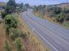
North along SH59 from Plimmerton Roundabout
Active NZTA Alerts Near This Camera
Fire — SH 1 TG, near Rainbow Bridge, northbound.
Due to a prior car fire, the northbound right lane is closed north of the Pauatahanui Interchange. Expect delays.
Road Works — SH 58 Haywards, between Flightys Road and Moonshine Road
Due to works for the SH58 Safety Improvements Project, there are temporary lane shifts and various speed restrictions in place. Plan your journey accordingly, allowing extra time to travel through this area.
❓ Frequently Asked Questions about SH59 Plimmerton
How often is the SH59 Plimmerton traffic camera updated?
Images from SH59 Plimmerton are refreshed every 60 to 120 seconds directly from the Waka Kotahi NZ Transport Agency highway monitoring network.
Where is SH59 Plimmerton located on the highway network?
This live camera is positioned along State Highway SH59 in the Wellington region at GPS coordinates -41.0830, 174.8690.
How can I check if the road at SH59 Plimmerton is open or affected by weather?
KiwiCamsNZ displays the live visual feed alongside real-time weather metrics (temperature, wind gusts) and official NZTA hazard notifications within a 15km radius.
Nearby Monitoring
Route Progress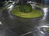

About the Author
Víctor Alonso
IT Engineer · Full-Stack Developer · Spain
Computer Engineer specialising in high-performance web platforms and SEO infrastructure. Creator of KiwiCamsNZ, the NZ traffic camera aggregator, and several digital products across Europe and New Zealand.
Journey Safety
Always verify multiple cameras along your planned route. Visual data provides context that GPS maps might miss.
View All NZ Alerts